The weather across Lawton and nearby parts of Oklahoma is looking a bit tricky over the next few days. This morning’s mesoscale convective system, or MCS, has already moved out of the area, but it has left behind an atmosphere that is not very easy to predict. Through the afternoon, people can expect a mix of sunshine and clouds.
Even though things may look calm for some time, the bigger concern is what could happen later in the day as another weather system starts moving in. There is still a chance for severe storms, but it depends on whether the atmosphere can recover enough to support storm development.
Weather Conditions This Afternoon
After the morning storms moved away, they took some of the energy out of the atmosphere. That matters because strong thunderstorms need warm, moist, unstable air to grow. Right now, the air may not be as charged up as it was earlier.
At the same time, another issue is the presence of a “cap.” In weather terms, a cap is a layer of warm air above the ground that stops air from rising freely. When this happens, storms struggle to form, even if there is moisture and heat near the surface.
Because of that, the forecast for this afternoon is not fully clear. There are two possible outcomes:
- Very little may happen, and the day could remain mostly quiet
- One or two storms may manage to break through the cap and become severe very quickly
This is why meteorologists are watching the sky very closely.
Why Severe Storms Are Still Possible
Even though the atmosphere lost some energy this morning, severe weather cannot be ruled out. An upper-level wave is expected to move into the region later in the day. This type of weather feature can provide the lift needed to help storms develop.
There is also a dryline in the area. A dryline is a boundary between dry air and moist air, and it often becomes a focus point for thunderstorm development in the Plains. If enough lift forms along or ahead of the dryline, a severe thunderstorm or two could develop.
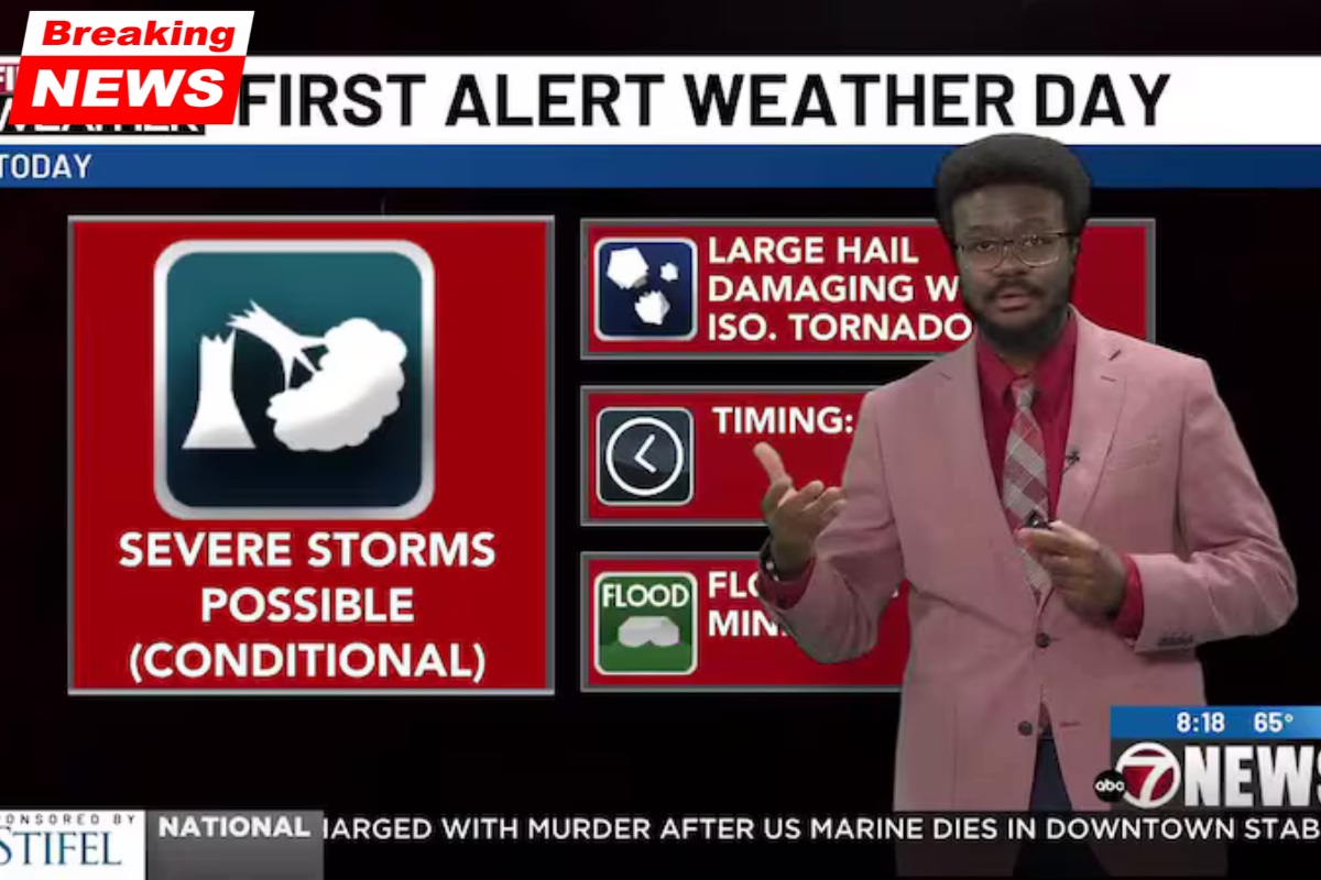
If storms do form, they may become dangerous because the atmosphere still has some ingredients needed for severe weather. These storms could bring:
- Large hail
- Damaging winds
- Heavy rain
- Frequent lightning
In some cases, isolated severe storms can become intense very fast, which is why even a low number of storms can still be a big concern.
Greater Storm Chances From Tomorrow Through Wednesday
The forecast becomes more active after today. A second upper-level low, which was earlier located in the Gulf of Alaska, is now moving into California. Systems like this often send smaller disturbances, called shortwaves, across the central United States.
These shortwaves can increase storm chances over Oklahoma, especially when a dryline is already in place. Because of this setup, thunderstorm chances are expected to continue tomorrow and may remain in the forecast through at least Wednesday.
At this stage, tomorrow through Wednesday looks more favourable for severe weather than today. That does not mean severe storms will definitely happen everywhere, but the overall setup seems more supportive.
Forecast Overview
| Day | Expected Conditions | Severe Weather Risk |
|---|---|---|
| Today | Mix of sun and clouds, possible isolated storm development later | Low to moderate, but any storm could turn severe |
| Tomorrow | More storm chances due to shortwaves and dryline | Moderate |
| Wednesday | Continued storm potential in the area | Moderate |
What Makes This Forecast Uncertain
Weather forecasting is not always straightforward, especially during severe weather season. There are still many small details that can change how the forecast plays out. For example:
- If the cap stays strong, storms may not form at all today
- If the atmosphere recovers faster than expected, severe storms could develop
- The exact position of the dryline can change where storms form
- Small upper-level disturbances can affect storm timing and intensity
This is why meteorologists often say they are still “ironing out the details.” The general setup shows a risk, but the exact timing and severity are still being studied.
What Residents Should Keep in Mind
People in Lawton and surrounding areas should stay weather aware over the next few days. Even if today ends up being quiet, the chance of severe weather may increase again tomorrow and Wednesday.
It is a good idea to:
- Check updated forecasts through the day
- Keep phone alerts turned on
- Know where to take shelter if a warning is issued
- Avoid ignoring weather changes just because the morning storm has passed
Sometimes the most dangerous storms form later in the day after a quiet afternoon, so staying informed is important.
The weather pattern over Lawton is entering a more active phase, and while today’s storm chances remain uncertain, the risk is far from over. Morning storms have reduced some of the energy in the atmosphere, and a warm cap may stop widespread development, but one or two severe thunderstorms are still possible if enough lift arrives near the dryline.
Looking ahead, the setup from tomorrow through Wednesday appears more supportive for stronger storms as additional weather systems move in from the west. Since the forecast still depends on several changing details, residents should follow updates carefully and stay prepared for possible severe weather at short notice.