A foggy start greeted residents across Oklahoma City on Thursday morning, with mist and low visibility making travel difficult across the metro area. Weather officials say the fog could slow down the morning commute, while conditions later in the day may shift from fog to potentially severe storms.
Dense Fog Covers Oklahoma City Thursday Morning
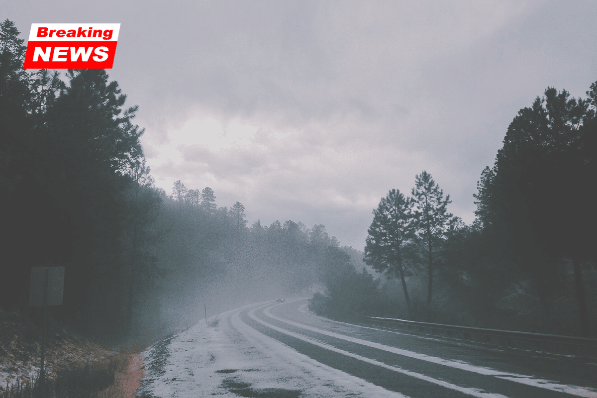
Residents woke up to thick fog and mist across Oklahoma City, with temperatures in the low 50s early Thursday. The heavy fog has reduced visibility across several parts of the metro area, creating potentially dangerous driving conditions.
The National Weather Service issued a Dense Fog Advisory for parts of central and western Oklahoma until 9 a.m. CST. Forecasters say visibility in some areas could drop to one-quarter mile or less, making it harder for drivers to see vehicles, traffic signals, and road signs.
Morning Weather Snapshot
| Weather Factor | Details |
|---|---|
| Temperature | Low 50s early morning |
| Visibility | As low as ¼ mile in some areas |
| Advisory | Dense Fog Advisory until 9 a.m. CST |
| Area Affected | Central and western Oklahoma |
| Main Risk | Hazardous driving conditions |
Advice for Drivers During the Fog
Authorities are urging drivers to be extra cautious during the morning commute. Fog can make roads unpredictable because visibility can change quickly from one block to the next.
Drivers are advised to follow these safety tips:
- Slow down and drive carefully
- Turn on headlights so other drivers can see you
- Keep extra distance between vehicles
- Allow additional travel time for your commute
Even after the advisory ends, some areas may still experience patchy fog, especially in low-lying locations.
Storm Threat Expected Later Thursday
Weather conditions could change quickly later in the day. Forecasters say attention will shift from fog to the possibility of severe thunderstorms Thursday evening and overnight.
Storms are expected to first develop in western Oklahoma and the Texas Panhandle before moving east toward central Oklahoma overnight.
Meteorologists say some storms could become strong and bring several hazards.
Possible Severe Weather Risks
- Large hail
- Damaging wind gusts
- Heavy rainfall
- A few isolated strong tornadoes
People who plan to be outdoors Thursday evening are encouraged to stay alert for weather updates.
Afternoon Weather Before Storms Arrive
Before the storms develop, temperatures Thursday afternoon are expected to warm up significantly. Highs should reach the upper 60s to near 70°F across Oklahoma City.
Southeast winds could also become stronger during the day, with gusts reaching the mid-20 mph range.
These warmer and windy conditions will help create the unstable atmosphere that may lead to storms later in the evening.
Thursday Afternoon Forecast
| Weather Element | Expected Conditions |
|---|---|
| High Temperature | Upper 60s to around 70°F |
| Wind Direction | Southeast |
| Wind Gusts | Up to mid-20 mph |
| Storm Timing | Late evening into overnight |
Friday Could Bring More Storms and Strong Winds
Friday is expected to be even warmer across the region. Forecasts suggest temperatures may climb close to 78°F, with strong south winds gusting up to 35 mph.
Showers and thunderstorms may develop again during the afternoon and evening hours, meaning severe weather risks could continue into the end of the workweek.
Residents are encouraged to monitor local weather updates and keep their phones charged in case warnings are issued.
Cooler Weather Expected by Saturday
After several days of wind and storm chances, conditions are expected to improve by the weekend.
A cooler and drier air mass should move into the region on Saturday, bringing:
- Mostly sunny skies
- Cooler temperatures
- Highs in the upper 50s
This shift should provide calmer weather across central Oklahoma after the stormy pattern.
Stay Updated on Weather Alerts
Because weather conditions can change quickly, especially when severe storms are possible, residents should stay informed through official weather alerts.
Check updates from the National Weather Service and local emergency alert systems before heading out Thursday evening.
Officials say they will continue to monitor conditions and update advisories or warnings if necessary.